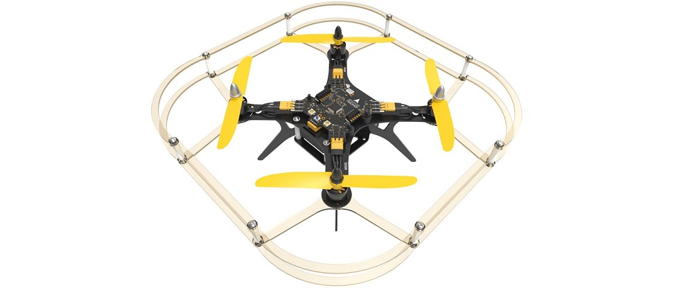
Quadcopter Geoscan Pioneer
A kit for creating and programming unmanned aerial vehicles, which will allow students of schools, aircraft modeling sections and robotics clubs to master useful skills and learn about modern professions. With the help of the Geoscan Pioneer set, you can integrate the latest technical advances into the educational process. Various documentation, including design drawings, helps to study the capabilities of the copter, repair and upgrade it. The simple design and availability of drawings allow you to replace almost any part: frame, propeller group, modules, etc., thus creating your own unique quadcopter. Stabilization systems make it easier to control, and all-round protection will prevent the propellers from breaking if a fall does occur for one reason or another. Manual control is possible using the remote control. The new adapter board integrates an optical positioning system for flights along a given route indoors or outdoors. Implements the functions of a trusted environment: Provides control over the loading of the manufacturer's original firmware. Generates and stores a unique identification number for the drone. Fixes the key parameters of the copter's flight in a "black box". Logs can be viewed using the Pioneer Station application. Provides control over the execution of the flight mission. It is possible to set restrictions on the flight zone in the local navigation system.
- Contents: Frame Base plate Brushless motors Efficient and reliable Fasteners Battery Propellers Tools Charger Protection Remote control USB cable Instructions
- Flight duration: up to 17 minutes
- Max. permissible wind speed: up to 5 m/s
- Flight speed: up to 65 km/h
- Max. flight altitude: 500 m
- Operating temperature: from 0 to +40 °C
- Motors: brushless, 1306 3100 KV
- Takeoff/landing: Vertical
- Overall dimensions: 290x290x120 mm
- Quadcopter weight: 230 g.
- Max. take-off weight: 420 g.